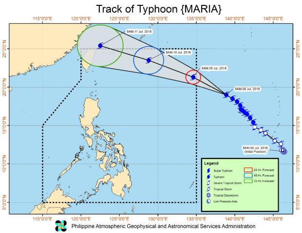

Maria, which will be locally known as “Gardo” once it enters PAR, was last located at 1,625 km east of Northern Luzon, packing maximum sustained winds of 190 kilometers per hour with a gustiness of up to 235 kilometers per hour.
Maria, which is now moving northwest at a faster speed of 23 kph, is expected to enter PAR on Tuesday morning (July 10).
Meanwhile, Pagasa warned that light to moderate and occasional heavy rains strengthened by the southwest monsoon could cause flash flooding and landslides in Metro Manila, Mimaropa, Calabarzon, Western Visayas, and the provinces of Cagayan, Isabela, Quirino, Aurora, Bataan, and Zambales.
Elsewhere, there will be heavy rains with lightning and strong winds in Pampanga, Zambales, Bataan, and some parts of Nueva Ecija, Tarlac and Bulacan.
The rest of the country may have partly cloudy skies with isolated rain showers due to localized thunderstorms. /atm