


New possible storm spotted near PH; may enter PAR on Thursday
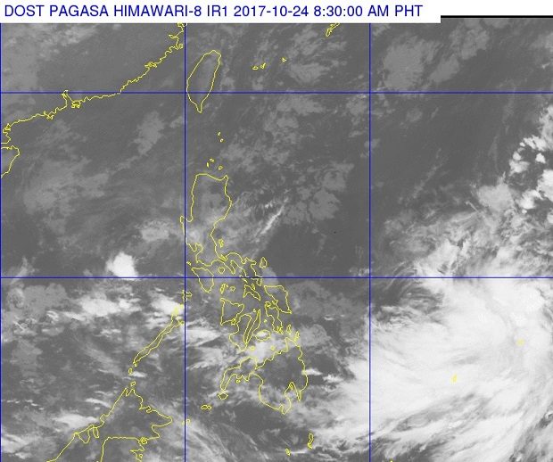
A large mass of clouds on the lower right corner of the satellite photo released by Pagasa on Tuesday, Oct. 24, 2017, shows the approximate location of a new tropical depression outside the Philippine area of responsibility. The potential storm may enter the Philippine area of responsibility on Thursday or Friday, Pagasa said. PAGASA IMAGE
While an intertropical convergence zone (ITCZ) is affecting Southern Luzon and the Visayas, the weather bureau said it was monitoring a tropical depression outside the Philippine area of responsibility (PAR) as of Tuesday morning.
The Philippine Atmospheric, Geophysical and Astronomical Services Administration (Pagasa) said the tropical depression was estimated at 2,145 km east of Mindanao at 3 a.m.
It was charging maximum winds of 45 kph and gusts of up to 60 kph as it moved northwest at 15 kph, Pagasa said in its 4 a.m. weather bulletin.
Weather specialist Gener Quitlong said the depression, which is not yet affecting the country, was expected to enter the PAR on Thursday or Friday, and would be named “Quedan.”
Meanwhile, due to the ITCZ, Mindanao, Western Visayas and Palawan would experience cloudy skies with scattered rains and thunderstorms.
Metro Manila and the rest of the country would have partly cloudy to cloudy skies with isolated rainshowers or thunderstorms mostly in the afternoon or evening, due to localized thunderstorms, Pagasa added. /cbb


