


Clouds and rain forecast over Luzon
PAGASA PHOTO
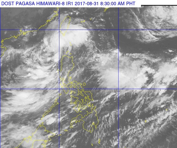
A low pressure area (LPA) was spotted northwest of Laoag City in Ilocos Norte, the state weather bureau reported Thursday morning.
“At 3:00 AM today, the LPA was estimated based on all available data at 95 km North northwest of Laoag City, Ilocos Norte,” the Philippine Atmospheric, Geophysical and Astronomical Services Administration (Pagasa) said in its 4 a.m. forecast.
Pagasa said it was also monitoring severe tropical storm “Sanvu” at the extreme Northern Luzon, which was still outside the Philippine area of responsibility (PAR).
Due to these weather systems, the Ilocos region and the province of Batanes and the Babuyan group of Island will experience cloudy skies with moderate to occasionally heavy rain, and thunderstorms.
Meanwhile, Metro Manila and the regions of Cordillera, Central Luzon, Rest of Cagayan Valley and provinces of Mindoro, Cavite and Batangas should expect cloudy skies with light to moderate rain and possible occasionally heavy rain due to thunderstorms.
The rest of the country will have partly cloudy to cloudy skies except for isolated light to occasionally heavy rain, gusty winds and lightning will prevail, the state weather agency added.
Moderate to strong winds blowing from the southwest to south will prevail over Northern and Central Luzon and coming from the southwest over the rest of country, while the coastal waters throughout the archipelago will be moderate to rough, Pagasa said. CBB


