


LPA develops into tropical storm upon PAR exit
Screengrab from pagasa.dost.gov.ph
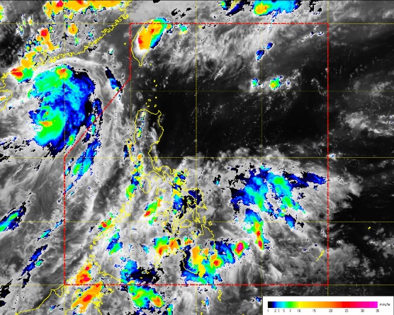
The low pressure area (LPA) which triggered rains in Luzon over the weekend has exited the Philippine area of responsibility on Sunday, though it still picked up strength and continued to affect some areas in northern Philippines on Monday.
As of 4 p.m., “Merbok” was estimated to be 740 kilometers west of extreme northern Luzon, packing maximum sustained winds of 75 kilometers per hour and gustiness of up to 90 kph, moving north-northwest at 25 kph.
While the tropical storm is already outside PAR, and is not expected to re-enter, Philippine Atmospheric, Geophysical and Astronomical Services Administration (Pagasa) weather forecaster Meno Mendoza said as of Monday morning, it still continued to bring light to moderate rains and thunderstorms in Zambales and Pangasinan.
By the afternoon of Monday however, it was already the ridge of a high pressure area bringing rains to central and southern Philippines. In its 24-hour forecast on the high pressure area’s effects, Pagasa warned of cloudy skies with light to moderate rains and thunderstorms over the regions of eastern Visayas, Caraga, Davao and Soccsksargen.
Partly cloudy to cloudy skies with isolated rainshowers or thunderstorms will prevail over Metro Manila and the rest of the country, Pagasa said.
Mendoza said no gale warning has been raised, but cautioned the western side of Luzon to be wary of moderate to rough seas.


