


CoA flags inadequate rules on disaster risk assessment
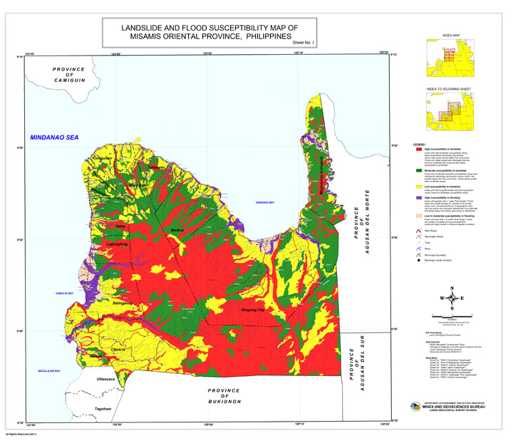
An example of a geo-hazard map issued by the Mines and Geosciences Bureau on Misamis Oriental. (Photo of the map was featured on the official website of the Environmental Science for Social Change — www.essc.org.ph )
MANILA — The Commission on Audit has flagged the lack of adequate guidelines in government agencies’ coordination, monitoring and updating of the country’s disaster risk assessment systems.
The CoA recently issued its 33-page performance audit report on the Geo-Hazard Mapping and Assessment Program, which stressed the need to “adopt clear-cut policy guidelines or procedure” in updating the geo-hazard maps that provide information on areas at risk during disasters.
Although it noted the Mines and Geosciences Bureau had undertaken the updating of hazard maps in 2015, the audit report still cautioned that the lack of guidelines would result in a lack of consistency.
Even as the maps of three mapping agencies—MGB, as well as National Mapping and Resource Information Authority and the Department of Science and Technology—have been serving different purposes, the CoA said guidelines should be laid out to ensure accuracy.
No guidelines on coordination
The CoA also reported that the National Disaster Risk Reduction Management Council (NDRRMC) and the Department of Science and Technology (DoST) have not issued adequate guidelines on inter-agency coordination.
This meant that the implementation of the National Disaster Risk Reduction and Management Plan (NDRRMP) has not been well-coordinated and the accountability of the agencies has not been well-defined.
“Hence, the country’s DRRM is wanting of clear policy guidelines for a well-coordinated disaster prevention and mitigation efforts,” the report read.
The report said that despite their vital roles, the DoST and the Office of Civil Defense have not reviewed and monitored the Mines and Geosciences Bureau’s planning of the updates on the Geo-Hazard Mapping and Assessment Project (GhMAP).
DoST and OCD serve vital functions as vice-chairperson for disaster prevention and mitigation and lead agency for enhanced community-based monitoring, respectively.
But, the CoA said they have only supervised the projects they implement, and have not coordinated and reviewed the updating of the GhMAP.
No budget for monitoring
The CoA also observed that the OCD had inadequately monitored the program, which meant there was no assurance that the effectiveness of the program had been consistently evaluated.
The OCD is responsible for ensuring the implementation of the NDRRMP, and the integration of local governments’ DRRM plans in their development and land use plans.
But, the CoA found that the OCD was unable to validate the agencies’ accomplishment reports because, from 2013 to 2015, Congress did not at all provide it with the capital outlay to purchase the necessary equipment. OCD also turned out to be understaffed, as only 59 percent of its 644 positions were filled up.
Well-utilized
Still, the CoA found that generally, local government units were able to utilize the geo-hazard maps in formulating their local disaster preparedness and comprehensive land use plans.
It cited a survey of 79 local government units in Central Luzon, Calabarzon, and Western Visayas. Seventy-six of them (96 percent) have taken the maps into account for their planning activities, although only 45 of the LGUs (60 percent) used the latest maps provided by MGB.
Even then, the disaster risk assessment helped “contribute to the reduction of vulnerabilities and exposure of communities in case of disasters,” the report noted.
It highlighted Antipolo City, site of the deadly Cherry Hills Subdivision landslide in 1999, as well as Pasig City as examples of cities that have integrated the disaster preparedness plans into their zoning ordinances. Marikina City, meanwhile, was cited for initiating a “systemic evacuation program or camp management system.”
At the time of the audit of the geo-hazard program, no government-wide or sectoral audit of disaster management had been conducted.
The CoA only recently released its first-ever audit on government agencies and units’ use of disaster risk reduction and management funds, finding that local governments and the Department of National Defense have failed to comply with pertinent rules. SFM/rga


