


Typhoon ‘Karen’ accelerates; new storm moving in
SCREENGRAB FROM Pagasa website
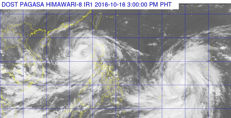
Typoon “Karen” (international name: Sarika) slightly accelerated on Sunday afternoon over the coastal waters of Pangasinan as another weather disturbance neared the Philippine Area of Responsibility (PAR), the state weather bureau said.
In its 2 p.m. bulletin, the Philippine Atmospheric, Geophysical and Astronomical Services Administration (Pagasa) said Signal No. 1 was hoisted over Ilocos Sur, Pangasinan, Tarlac, Zambales, Benguet and La Union.
Storm signals elsewhere have been lifted.
“Karen” packed maximum sustained winds of up to 120 kilometers per hour (kph) near the center and gustiness of up to 200 kph as it moved west northwest at 24 kph.
The typhoon was last plotted at 175 km west northwest of Dagupan City, Pangasinan. It was expected to exit PAR on Monday morning.
Pagasa said severe tropical storm “Haima,” which was located at 1,575 km east of Visayas, was expected to enter the eastern boundary of the PAR on Monday. It will be locally named “Lawin.” YG/RAM/rga


