


Signal No.1 up in 5 areas due to TD ‘Julian’
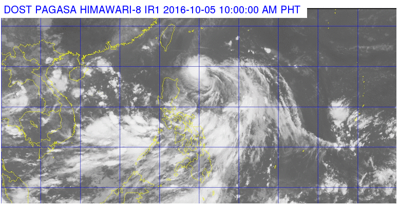
This satellite image from Pagasa shows the location of tropical depression Julian as of 10 a.m. Wednesday.
The low pressure area east of Luzon has developed into a tropical depression and was named “Julian,” according to the state weather bureau.
In its 24-hour weather forecast, the Philippine Atmospheric, Geophysical and Astronomical Services Administration (Pagasa) said Julian was packing maximum sustained winds of 45 kilometers per hour (kph) and gustiness of up to 55 kph near the center.
The weather disturbance was last plotted at 720 km East of Calayan, Cagayan, moving west northwest at 25 kph.
Signal No. 1 was raised over Batanes, northern Cagayan including Babuyan Group of Islands, Apayao and Ilocos Norte.
Pagasa said rains will be experienced over Cagayan and the islands of Batanes, while Metro Manila and the rest of the country will have cloudy skies with light to moderate rains and isolated thunderstorms.
Intropical Convergence Zone (ITCZ) was also affecting Southern Luzon, Visayas and Mindanao, Pagasa added.
RELATED STORY
‘Igme’ leaves but 2 storms seen


