


Phivolcs launches, distributes handbook on West Valley faultline in Metro Manila
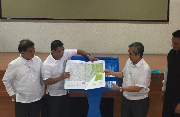
The Valley Fault System Atlas, a handbook which details areas traversed by the Valley Fault System in Metro Manila and nearby provinces, was launched and distributed to local government officials on Monday, at the Philippine Institute of Volcanology and Seismology headquarters in Quezon City. In photo is MMDA Representative Atty. Emerson Carlos, Phivolcs Director Renato Solidum, NDRRMC Executive Director Alexander Pama and UNDP Philippines Country Director Titon Mitra. FRANCES MANGOSING
Is your place near an earthquake faultline? If you want to avoid it, where’s the ideal place to relocate?
Renewed fears of a possible earthquake in Metro Manila grew after the devastating 7.8 magnitude tremor in Nepal recently. While an earthquake cannot be predicted, Philippine Institute of Volcanology and Seismology Director Renato Solidum said a strong 7.2 magnitude earthquake can possibly occur in this lifetime.
“This fault has moved in the past 1,400 years four times with the average interval of 400 to 600 years. The last earthquake that can be related to this happened in 1658, which is 357 years ago. This is very close to the limit of 400 years. Please note that active faults don’t really follow exact averages; it can go earlier or later…It is possible that the movement of this fault can happen in our lifetime,” he said on Monday.
MMDA: Metro residents must brace for strong quake
The fault can generate a destructive 7.2 magnitude earthquake, he said.
“The West Valley fault is roughly 100 kilometers. This distance if ruptured will produce 7.2 magnitude earthquake so don’t ever think there will be a magnitude 8 or 9 from this fault. The magnitude of an earthquake is limited to the length of the fault and the energy stored beneath the rocks,” Solidum said.
A study presented by Phivolcs and Australian government in 2013 showed that an earthquake of such magnitude could kill 37,000 people in an instant and injure 604,000 persons. It would also cause an estimated damage of P2.4 trillion to buildings.
Metro Manila after a 7.2 magnitude quake
The Valley Fault System Atlas, a handbook of large scale maps that detail areas traversed by the Valley Fault System, was launched and distributed to local government units on Monday at the Phivolcs headquarters in Quezon City.
The Valley Fault System is comprised of the 10 kilometer East Valley Fault in Rizal and 100 kilometer West Valley Fault which spans through the different cities and towns of Bulacan, Rizal, Metro Manila, Cavite and Laguna.
“Without the knowledge where the fault is we will not be able to establish proper zoning ordinances so we can minimize potential risk to infrastructures and to people,” he said.
The atlas, is an initial tool, that is “simplified,” National Disaster Risk Reduction and Management Council Executive Director Alexander Pama said.
The map may be used for land-use, planning, engineering and construction, scientific research, disaster risk reduction and mitigation. It has 33 map sheets of varying scales.
“All we have to do is look at the atlas, look where the red lines are. Tingnan kung saan natin ilulugar ang sarili natin…This is a solid reference in the selection of evacuation centers, safe routes. We have tried to laymanize this..” he added.
Study: 37,000 may die if 7.2 quake would hit Metro Manila
Geologists worked on the atlas for about two years. They took aerial photos, visited the field to find out where the faults are, even in “dangerous areas”. Then they had peer review to map the fault to validate, Solidum said.
He said that putting up structures on active fault lines must be avoided to enhance the safety and resilience of communities.
“One of the things we must do is to prevent further establishment of houses, buildings and consider the fault in developing infrastructures in the metropolis and surrounding provinces. We should not build on top of an active fault and have a buffer zone of five meters on both sides. This is very important in land use planning in development and use information so we can prioritize our assistance during large earthquakes and big events,” he said.


