


Storm strengthens, inches closer to Philippines
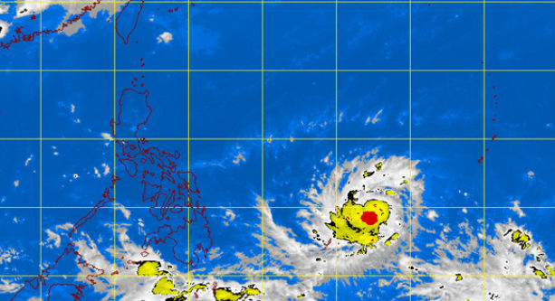
MT Satellite image May 6, 2015, 9:01 a.m. Screengrab from https://kidlat.pagasa.dost.gov.ph/index.php
TROPICAL Storm Noul intensified as it moved closer to the Philippines, data from the weather bureau showed.
Noul was packing maximum sustained winds of 100 kilometers per hour (kph) near the center and gusts of up to 130 kph, the Philippine Atmospheric, Geophysical and Astronomical Services Administration (Pagasa) said in its 5 a.m. bulletin Wednesday.
Earlier, in its 5 p.m. Tuesday bulletin, Pagasa said Noul had maximum winds of 85 kph and gusts of 100 kph as it moved west towards the Philippine area of responsibility (PAR). It is expected to enter the PAR on Thursday after which it will be named “Dodong.”
In the latest Pagasa bulletin, the storm was found to be 1,395 kilometers east of Surigao del Norte as it continued its westward track at 6 kph.
A ridge of high pressure area east of the Philippines was affecting Luzon, Pagasa said.
The whole country will experience partly cloudy to cloudy skies with isolated rainshowers or thunderstorms.
Light to moderate winds blowing from the east to southeast will prevail over Luzon and coming from the east to northeast over the rest of the country.
Coastal waters throughout the archipelago will be slight to moderate.


