


‘Chedeng’ maintains strength as it nears Luzon
pagasa.dost.gov.ph/
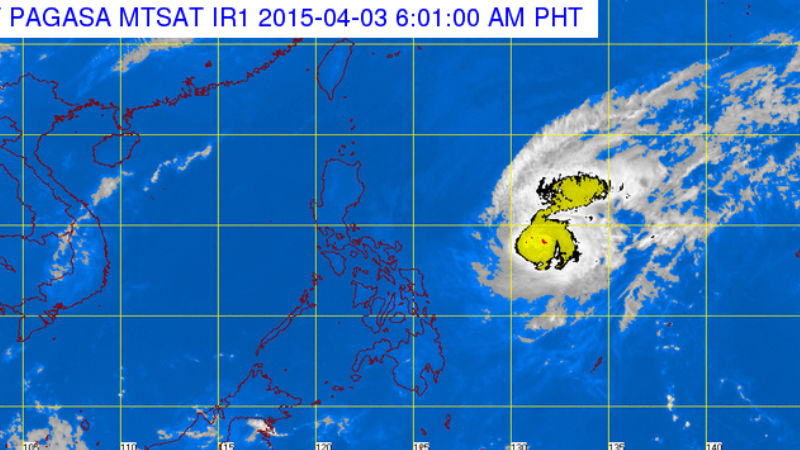
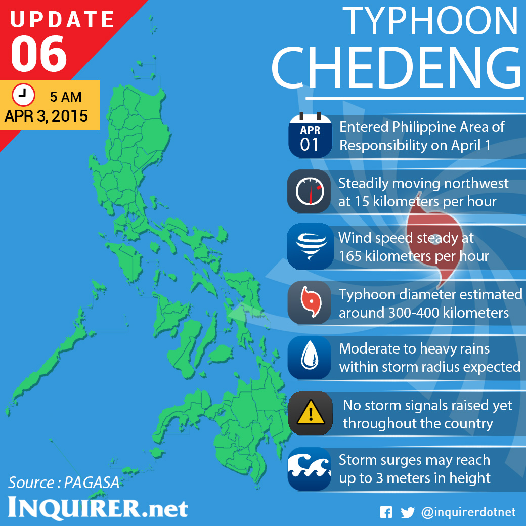
MANILA, Philippines–Typhoon Chedeng (Maysak) maintained its strength since Thursday night as it neared Luzon, the state weather bureau said.
The typhoon was last observed 810 kilometers east of Virac, Catanduanes and packed maximum sustained winds of 165 kilometers per hour near the center and gusts of up to 200 kph, the Philippine Atmopsheric Geophysical and Astronomical Services Administration said on Friday.
Chedeng continued to move west northwest at 15 kph.
The whole archipelago will experience partly cloudy to cloudy skies with isolated rains or thunderstorms.
 Moderate to strong winds coming from the northeast to northwest will prevail over the eastern section of the country with moderate to rough seas, Pagasa said.
The weather bureau has also repeatedly warned for possible storm surges, flash floods and landslides.
Pagasa added that “Chedeng” is expected to make landfall on Sunday evening on the coasts of the Aurora-Isabela area.
“Chedeng” expected to exit the Philippine landmass via Ilocos Region on Monday morning and exit the Philippine Area of Reaponsibility Monday evening.
No public storm warning signals have been raised as of posting time. With a report from Bong Lozada. TVJ
RELATED STORY
‘Chedeng’ weakens, to make landfall Sunday evening


