


‘Chedeng’s’ eye vanishes, speed slows down
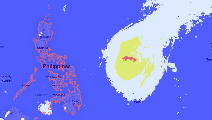
Satellite Image-April 2-4:02. SCREENGRAB from noah.dost.gov.ph
MANILA, Philippines – Typhoon “Chedeng” has slowed down as it continues its path toward the Philippine landmass, the weather bureau said Thursday afternoon as it noted that the typhoon’s eye had disappeared, an indication it is weakening.
In its weather forecast, the Philippine Atmospheric, Geophysical and Astronomical Services Administration said “Chedeng” now moves at 15 kilometers per hour from the faster 19 kph in its 11 am bulletin.

Source: Japan Meteorological Agency website (https://www.jma.go.jp/en/gms/largec.html?area=1&element=0&time=201504021130)
“Chedeng” has maintained its strength of 175 kph near the center and 210 kph gusts while taking a small shift in direction from a west northwest track to a northwest path.
Italian astronaut Samantha Cristoforetti has photographed the then powerful typhoon from the International Space Station showing the stunning eye of the weather phenomenon.
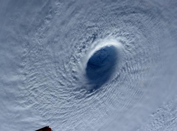
This image taken Tuesday March 31, 2015 shows Typhoon Maysak (Chedeng) taken by astronaut Samantha Cristoforetti from the International Space Station.
The photo of the eye was so breathtaking that the British tabloid Mirror described it “ a cloudy belly button.”
In her Facebook post, Cristoforetti said the typhoon “commands respect even from space.”
At 4 pm, “Chedeng” was spotted at 970 kilometers east southeast of Virac, Catanduanes.
Pagasa added that Cagayan Valley, Cordillera, and Ilocos will experience partly cloudy skies for Thursday until Friday.
Metro Manila and other parts of the country will be partly cloudy to cloudy with isolated rains.
Officials said they had readied rescue teams and relief goods to prepare for the typhoon’s landfall Saturday evening or early Sunday in northeastern Aurora or Isabela provinces and warned tourists headed to beaches for the Easter holidays to exercise caution.
Storm surges of up to 3 meters (nearly 10 feet) tall are possible in the eastern coast, while moderate to heavy rains are expected within a 200-kilometer (124-mile) radius from the typhoon’s center.
The weather bureau is set to issue a low-level storm warning later Thursday for the eastern provinces, which will suspend sea travel. The military went on alert Wednesday in the northern Philippines.
Pagasa said the storm was expected to weaken further after making landfall, and that it was possible it would be downgraded to a storm or tropical depression as it crosses land. AC


