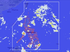
Cyclone likely to enter PAR Wednesday—Pagasa
MANILA, Philippines – The state weather bureau is tracking a cyclone that will likely enter the Philippine area of responsibility by Wednesday.
Ben Oris, weather observer from the Philippine Atmospheric Geophysical and Astronomical Services Administration, said Monday that the tropical depression was still over Pacific Ocean near Guam.
The tropical depression will be called “Huaning” once it enters the Philippine territory and will affect northern Luzon.
Meanwhile, an intertropical convergence zone is affecting Palawan and Mindanao.
“Ilocos Region, Mimaropa, Western Visayas and Mindanao will experience cloudy skies with light to moderate rainshowers and thunderstorms,” Pagasa said.
Metro Manila and the rest of the country will be partly cloudy to cloudy with isolated rainshowers or thunderstorms, it added.
Light to moderate winds blowing from the east to southeast will prevail over Luzon and coming from the east to northeast over Visayas and Mindanao. The coastal waters throughout the archipelago will be slight to moderate, it also said.


