LPA to bring rain in Mindanao–Pagasa

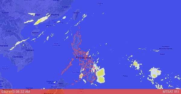
Project NOAH MTSAT image as of 8:32 AM, March 21, 2013. Screegrab from https://www.noah.dost.gov.ph/
MANILA, Philippines — The low pressure area in Mindanao will bring moderate to heavy rains in the area, the state weather bureau said Thursday.
Although there is little chance of intensifying into a cyclone, the LPA will affect the regions of Eastern and Central Visayas, Caraga and Davao, the Philippine Atmospheric Geophysical and Astronomical Services Administration said.
These areas will experience cloudy skies with moderate to occasionally heavy rainshowers and thunderstorms which may trigger flashfloods and landslides, it said.
The Bicol Region, the rest of Visayas and of Mindanao will be cloudy with light to moderate rainshowers or thunderstorms.
As of 4 a.m., the LPA was spotted 475 kilometers east of Hinatuan City.
Article continues after this advertisementMeanwhile, Metro Manila and the rest of Luzon will have generally good weather except for isolated thunderstorms mostly in the afternoon, Pagasa said.
Article continues after this advertisementMetro Manila also experienced its hottest temperature for the year at 34.6 degrees Celsius at 3 p.m. on Wednesday.
Moderate to strong winds blowing from the east to northeast will prevail over the eastern section of visayas and of Mindanao and the coastal waters along these areas will be moderate to rough.
Elsewhere, winds will be light to moderate coming from the east to northeast with slight to moderate seas, Pagasa said.