Weather forecasting in Philippines enters 21st century
Weather forecasting in the Philippines has finally entered the 21st century.
Scientists at the University of the Philippines who were pooled together by the Department of Science and Technology (DOST) set up in a span of a few months sophisticated weather monitoring systems not available to the country’s weather bureau during the catastrophe of Tropical Storm “Ondoy” in September 2009.
“We have developed seven tools for Pagasa’s (Philippine Atmospheric, Geophysical and Astronomical Services Administration) use to make their forecast more timely, accurate and reach more people,” Carlos Primo “CP” David of the UP National Institute of Geological Sciences (NIGS) said in a meeting with Philippine Daily Inquirer editors and reporters on Tuesday.
“These will make forecasting [and] predicting rainfall more high-tech. These will bring forecasting into the 21st century,” David said.
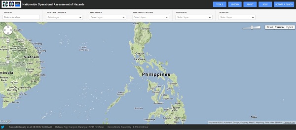
The new weather reading tools are part of the DOST’s Project Nationwide Operational Assessment of Hazards (Noah) which was officially launched only last month to augment Pagasa’s capability.
The new automated rainfall and flood prediction systems enabled Pagasa and Project Noah to give accurate forecasts and timely warnings during the unusual southwest monsoon rains two weeks ago that flooded large areas of Metro Manila and surrounding provinces.
“As Marikina has shown, the concept works. Filipino technology works. We have proven it. We were effective in giving the advisory,” said Enrico Paringit, chairman of the UP geodetic engineering department.
He was referring to the sudden burst of heavy rain in the late evening of August 8 that again flooded the Marikina River.
It had actually been raining since the start of the week but since the waters of the river had gone down that day, flood-weary residents had returned to their homes by the evening of August 8.
“We knew the floods were coming in the middle of the night,” said Project Noah executive director Mahar Lagmay of UP-NIGS.
Paringit, who heads the flood hazard mapping component of Project Noah, was among the first to be alerted to the sudden torrential rainfall that occurred in Montalban, Rizal province, at around 11:40 p.m. on August 8.
“Because of our rain gauge, we were able to see rainfall of 75 mm in an hour, and 40 mm in the next hour,” Paringit said. A 15 mm rainfall per hour is already considered heavy downpour.
“It was an unusual rainfall, like filling this room with 3 inches of rain in just one hour,” he added.
The water level at the Montalban Station was forecast to rise from 25 meters above water level to 27 meters.
The Marikina River, meanwhile, was forecast to rise from 14.7 meters above water level to the critical 20.4 meters in a few hours.
Paringit said he was alerted at 12:34 a.m. of Aug. 9 just as he was about to go to sleep.
“After I gave the forecast of heavy discharge from the Marikina watershed, we advised the proper alert to the LGUs (local government units),” he said.
“Surprisingly I was awake at one o’clock in the morning (of August 9),” Science Secretary Mario Montejo recalled.
With a window of a couple of hours to get the residents to safety, the DOST, Pagasa and Project Noah officials alerted disaster management officials and the media.
Montejo clarified the job of calling for an evacuation falls on disaster management and local government officials.
“We forecast a peak water level at Montalban Station at 2:40 a.m.. The forecast peak at Marikina River was 20.4 meters above water level at 4:40 a.m,” Paringit recalled.
His forecast was off by an hour. The actual peak at Marikina River was 20.42 meters at 5:40 a.m.
Paringit said they were able to make the forecast due to water level sensors that were giving data online.
“During Ondoy, we didn’t have automated online water sensors unlike last week. That was thoroughly monitored so we can predict where it will flood,” he said.
Luckily, Paringit’s team had just recently finished the 3D flood hazard mapping for the Marikina River system using the Lidar (Light Detection And Ranging) system.
The team used Lidar’s optical remote sensing technology (“like a camera”) to create a map of the area to forecast where it will flood during typhoons.
“We can say that this amount of rainfall will produce this amount of flooding to warn people of impending floods,” Paringit said.
“We started getting the data last March. By May we had a prototype,” he added.
He said they will next work on the Pampanga and Agno river systems using the two new Lidar equipment to be acquired by the DOST this month.
The equipment will be used to cover a total of 18 flood-critical river systems (including Marikina) since the existing flood maps are inaccurate and outdated.
Montejo said the Agno river flood mapping was developed by foreign technology through expensive foreign grants, “but this time we have Filipino scientists to do it.”
“It is local research and development and Filipino ingenuity at work,” he said.


