


‘Ompong’ to make landfall in Cagayan on Saturday – Pagasa
Updated: 1: 12 a.m., Sept. 13, 2018
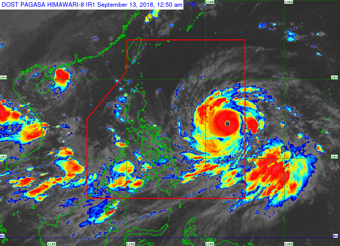
Typhoon Ompong (international name Mangkhut) maintained its strength Wednesday night as it continued to head toward Northern Luzon, where it it’s expected to make landfall at the northern tip of Cagayan on Saturday morning, according to the state weather bureau.
Signal No. 1 was raised over Camarines Sur and Catanduanes – where stormy weather is expected in the next 36 hours.
As of Wednesday night, Ompong was packing maximum sustained winds of 205 kilometers per hour near the center and gusts of up to 255 kph.
It was last spotted 1,005 kilometers east of Virac, Catanduanes, moving west northwest at a speed of 20 kph.
Storm signals may be raised over Cagayan, Isabela, Aurora, Quirino, Polilo Islands, Camarines Norte and Albay, Pagasa said.
Earlier on Wednesday, weather forecaster Gener Quitlong said the typhoon’s peak intensity could reach maximum sustained winds of 220 kilometers per hour near the center and gusts of up to 270 kph.
It will also cross Cagayan-Batanes area on Saturday morning.
The typhoon is expected to make landfall over the northern tip of Cagayan on Saturday morning
On Friday, strong winds, storm surges and heavy to intense rains may hit Cagayan and Isabela.
Quitlong warned of possible storm surges of up to 3 meters over the coast of the two provinces.
Ompong is the strongest tropical cyclone so far to hit the Philippines this year. /atm


